


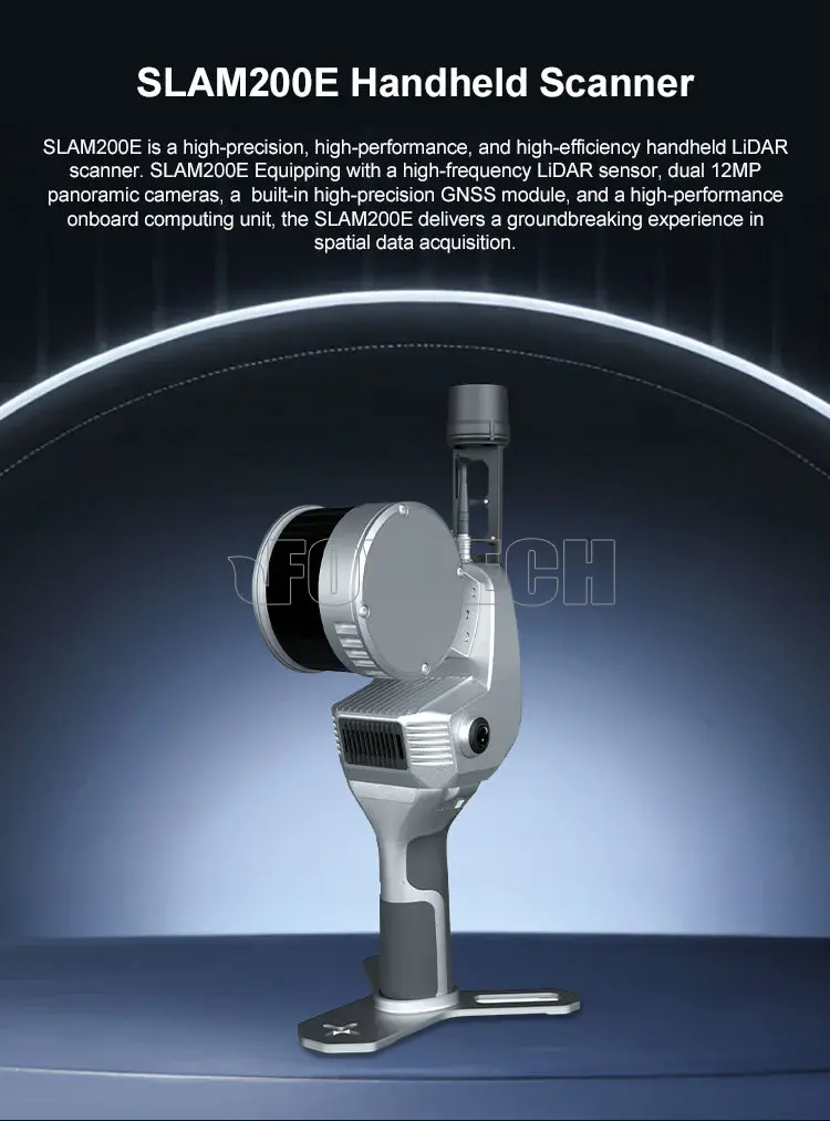
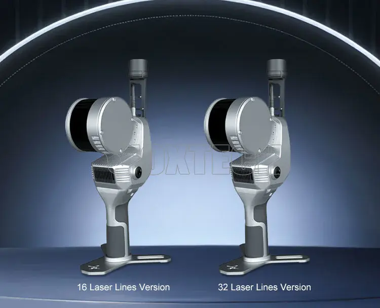
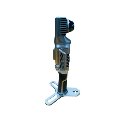
SLAM200E Handheld Scanner

- SKU:
- R2508271
- Weight:
- 1.00 KGS
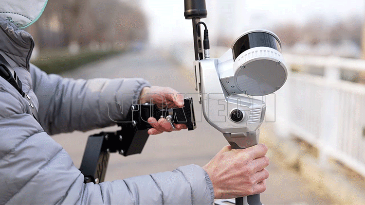
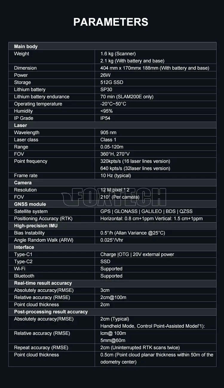
SLAM200E is a high-precision, high-performance, and high-efficiency handheld LiDAR scanner . SLAM200E Equipping with a high-frequency LiDAR sensor, dual 12MP panoramic cameras, a built-in high-precision GNSS module, and a high-performance onboard computing unit, the SLAM200E delivers a groundbreaking experience in spatial data acquisition. As a professional-grade mobile mapping tool, SLAM200E can enable accurate mapping even in GNSS-denied environments. The SLAM200E supports relative accuracy of 5 mm within a 60-meter range and achieves absolute accuracy of up to 2cm. Its integrated computing unit supports real-time data processing, allowing simultaneous data acquisition, mapping, and coloring. When connected to an external RTK module, it also enables real-time absolute coordinate mapping. With the SLAM Instant APP, the SLAM200E enables instant mapping upon completion of measurements, allowing for rapid on-site data collection of points, lines, areas, and volumes; For specific industries, it can even support on-site measurement report generation. As the updated version of its 1st generation product SLAM100 scanner, SLAM200E retains the outstanding performance of its predecessor while introducing multiple new features, including resuming scanning from last station, aerial-ground data fusion and 3DGS, etc. With these refined technical enhancements, the SLAM200E delivers a more convenient and efficient high-precision mobile measurement tool for users.
PRODUCT HIGHLIGHTS
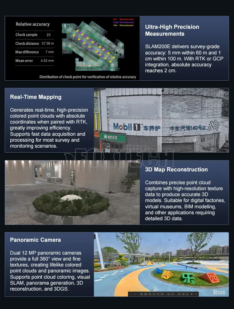
Ultra-High Precision Measurements
As a survey-grade high-precision mobile mapping tool, the SLAM200E supports relative accuracy of 5 mm within a 60-meter range and 1 cm within a 100-meter range. When connected to an RTK module or integrated with GCP, it can achieve absolute accuracy of up to 2 cm.
Real-Time Mapping
The SLAM200E delivers instant, high-precision, and colored point clouds, providing intuitive and detailed mapping results. When connected to RTK, the device outputs point clouds with absolute coordinates in real time, significantly enhancing operational efficiency. It supports real-time point cloud acquisition across a wide range of 80% typical application scenarios—including but not limited to urban surveying and engineering monitoring—Fast post-processing times.
3D Map Reconstruction
The SLAM200E combines high-precision point cloud capture with high-resolution texture data acquisition, enabling accurate 3D map reconstruction through both geometry and imagery. This makes it ideal for data collection in applications such as digital factories, virtual museums, BIM modeling, and other environments with stringent 3D data requirements.
Panoramic Camera
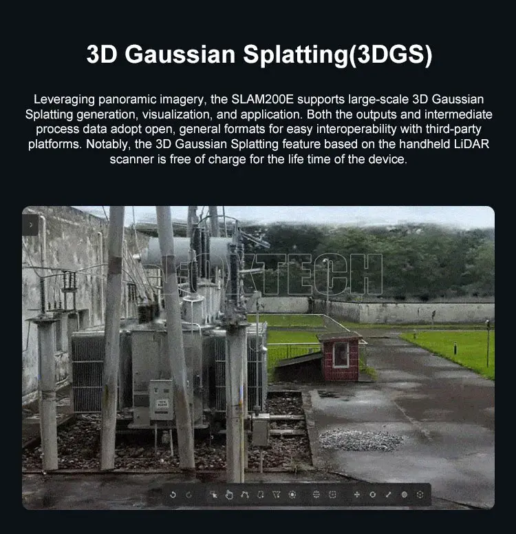
Equipped with dual 12MP panoramic cameras, SLAM200E captures a wide 360-degree field of view and fine texture details, producing lifelike colored point clouds and panoramic images. Panoramic data can be used for point cloud coloring, visual SLAM, panorama generation, 3D reconstruction, 3DGS, and more.
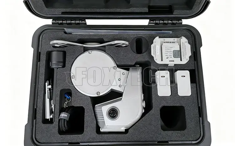
Your Purchase Includes:
1x SLAM200E LASER SCANNER
1x SP30 Handle Battery
1x Base for GCP
1x Antenna Components
1x Quick Release Base
6x M2.5*5.0 Screw
1x Smart Charger (EU)
1x Smart Charger (US)
1x Type-C to Type-C Cable
1x Screw Driver M2.5
1x USB Dongle


Related Products


SLAM200 High-Precision Handheld Imaging LiDAR Scanner with Built-in GNSS
SLAM200 is the third generation high-precision handheld laser scanner. SLAM200 LiDAR Scanner features a panoramic camera, a higher-performance laser sensor, built-in GNSS module and a more powerful...


Foxtech
MK32 Handheld Ground Control Station
MK32 Handheld Ground Station with RC, video, data and android system all-in-one features 15km long transmission range and great anti-interference performance. 7-inch High Definition & Brightness...


Foxtech
UniRC 7/7 Pro Handheld Ground Control Station
UniRC 7 / 7 Pro Handheld Ground Station with Integrated RC, Video, Data, and Android SystemAchieve up to 40 KM transmission range with advanced anti-interference technology, perfect for drones,...

Foxtech
SCAN 2100 3D LiDAR Scanner System for Industrial 3D Measurement & Safety Monitoring
SCAN 2100 3D LiDAR Scanner System consists of a servo gimbal, LiDAR sensor, and host processing software. By integrating the gimbal’s angular data with LiDAR measurements, it enables rapid...