


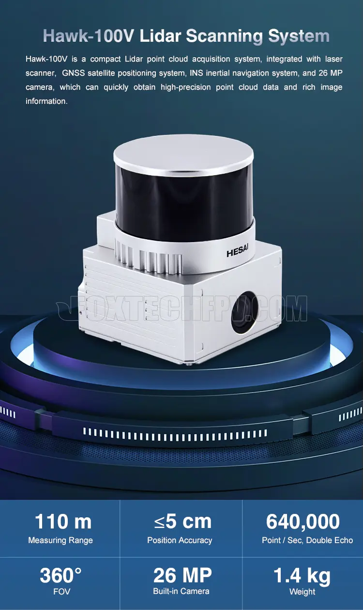
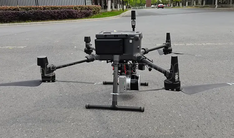
Foxtech Hawk-100V is a compact UAV Lidar point cloud acquisition system, integrated with a laser scanner, GNSS satellite positioning system, INS inertial navigation system, and 26MP camera, which can quickly obtain high-precision point cloud data and rich image information. It is widely used in city construction, forestry, agriculture, land planning, geological disasters, mine safety.
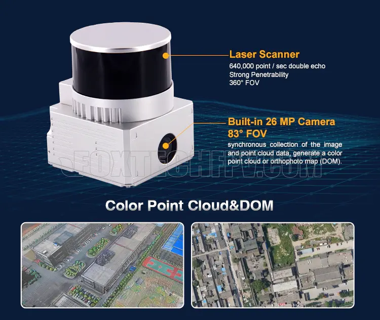
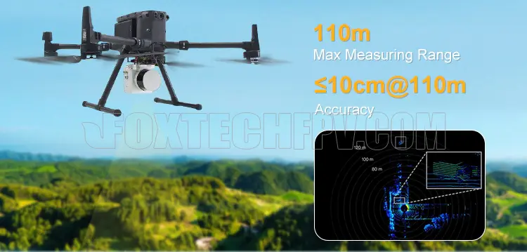
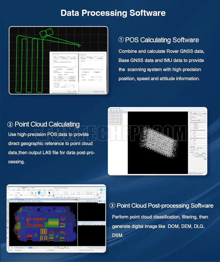
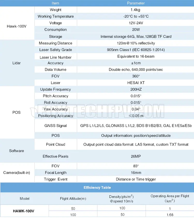
Hawk-100V Lidar Scanning System features 360° FOV, high point density (double echo, 640,000 point/sec), and high accuracy, the positioning accuracy is less than 5cm. The max measuring range is 110m. Mounted on multi-rotors it can quickly obtain the three-dimensional position and attribute information of ground objects in a large area, then generate digital images like DOM, DEM, DLG, DSM by using data processing software.
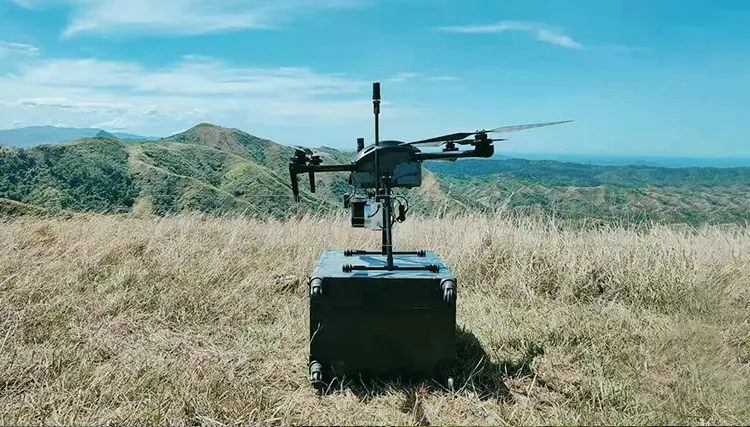
Owe to the lightweight and compact size, Hawk-100V Lidar can be easily mounted on multi-copters such as NAGA Pro and M300 for many different applications, such as objects classification and extraction, creating digital elevation models (DEMs) of specific landscapes, highlighting changes and abnormalities of vegetation growth.
Your Purchase Includes:
1x Foxtech Hawk-100V Lidar Scanning System
1x GNSS Antenna
1x GNSS Cable
1x Power Connection Cable
1x MICRO SD Card 128 GB
1x U Disk
1x Carry Case


Related Products


Foxtech
Hawk-260X Lidar Scanning System
Foxtech Hawk-260X is a compact and light weight Lidar point cloud data acquisition system, integrated with the new generation laser scanner, high precision GNSS and IMU positioning system, which is...

Foxtech
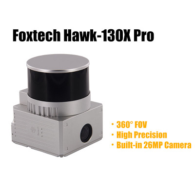
Hawk-130X Pro Lidar Scanning System
Foxtech Hawk-130X Pro is a compact UAV Lidar point cloud acquisition system, integrated with laser scanner, GNSS satellite positioning system, INS inertial...


Foxtech
Hawk-100C+ Drone Lidar Scanning System
Integrated with a laser scanner, GNSS satellite positioning system, INS inertial navigation system, and an A6000 camera, Hawk-100C+ is a high-precision UAV LiDAR point cloud data acquisition system...

Foxtech
SCAN 2100 3D LiDAR Scanner System for Industrial 3D Measurement & Safety Monitoring
SCAN 2100 3D LiDAR Scanner System consists of a servo gimbal, LiDAR sensor, and host processing software. By integrating the gimbal’s angular data with LiDAR measurements, it enables rapid...


TF Single Point Series LiDAR
The TF Single Point Series LiDAR offers five versions with varying ranges: 12 m, 40 m, 100 m, 180 m, and 350 m. These LiDAR systems enable real-time non-contact measurements...