




LiAir H600 Pro 1200m Surveying-Grade LiDAR Scanning System for DJI M300/M350 RTK/M400 | Power Line & Forestry Mapping
- SKU:
- 2608281
- Weight:
- 25.00 KGS
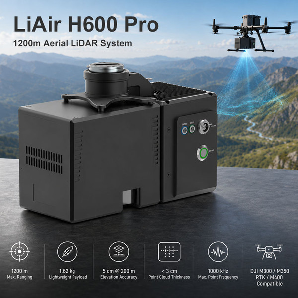
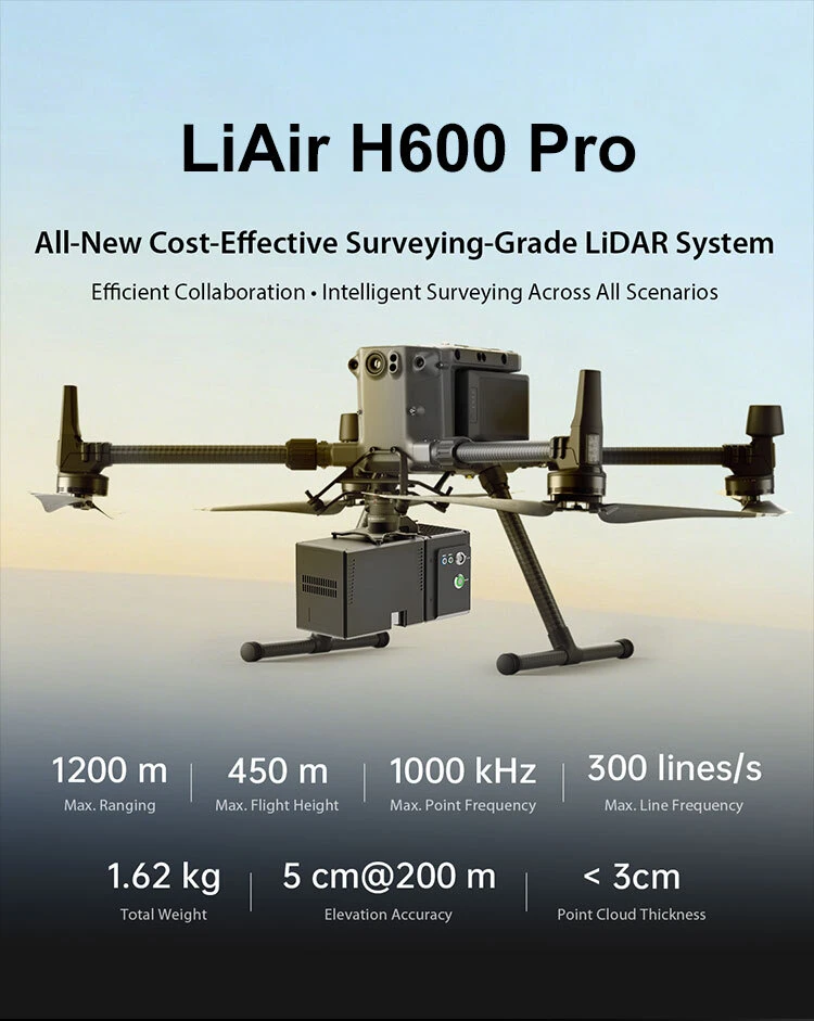
LiAir H600 Pro is a lightweight, surveying-grade UAV-mounted LiDAR scanning system designed for large-scale aerial mapping, power line inspection, forestry resource survey, and emergency disaster assessment. Integrating a survey-grade LiDAR unit, high-precision IMU, and high-resolution mapping camera into a 1.62 kg payload, it delivers up to 1200 m measurement range and professional point cloud data for aerial surveying workflows.
IDEAL FOR
Power Line Inspection
Forestry Resource Survey
Emergency Disaster Assessment
Large-Scale Terrain Mapping
UAV Mapping and Surveying Teams
NOTE
The aircraft platform is not included.
Software availability should be confirmed according to the selected package.
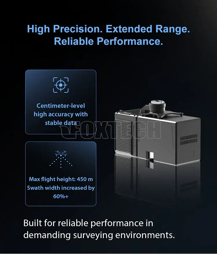
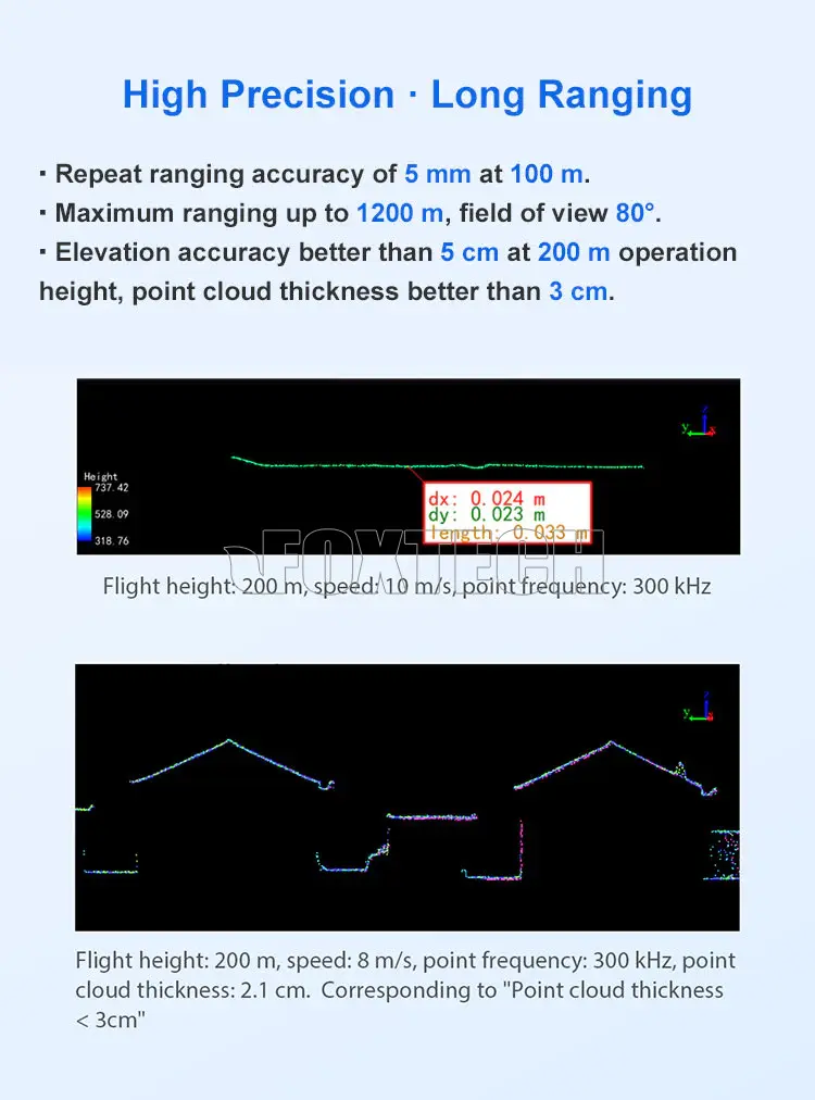
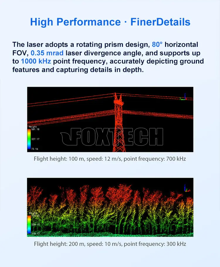
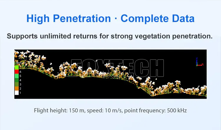
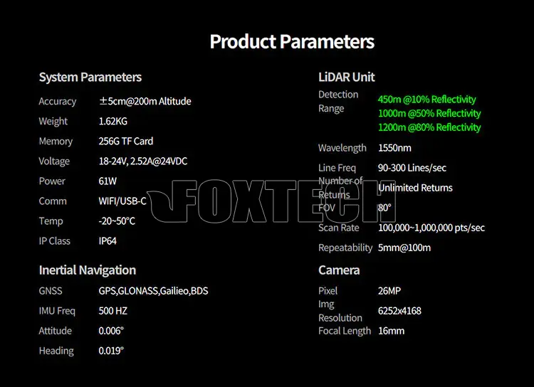
With ±5 cm vertical accuracy at 200 m, point cloud thickness better than 3 cm, unlimited returns, and a 1550 nm LiDAR sensor, LiAir H600 Pro provides high-quality point cloud output and strong vegetation penetration. It helps capture complete terrain data beneath forest canopies while maintaining efficient coverage for large-area mapping and corridor inspection.
KEY FEATURES
- 1200m Long-Range LiDAR Measurement
Supports up to 1200 m measurement range, making it suitable for medium- and long-range UAV surveying, corridor mapping, and large-area terrain data acquisition.
- 1.62 kg Lightweight Payload Design
With a total weight of only 1.62 kg, the system can be integrated with small-payload multi-rotor UAVs while helping improve flight endurance and operational efficiency.
- Surveying-Grade Point Cloud Accuracy
Delivers ±5 cm vertical accuracy at 200 m and point cloud thickness better than 3 cm, supporting high-quality 3D reconstruction and professional survey-grade mapping results.
- Unlimited Returns for Strong Vegetation Penetration
Unlimited returns and concentrated laser pulse energy help penetrate dense vegetation and capture more complete terrain data beneath forest canopies.
- 1000 kHz Pulse Rate and 80° FOV
A maximum pulse repetition rate of 1000 kHz and 80° horizontal FOV provide efficient wide-area scanning, with an effective swath width greater than 350 m at 200 m flight height.
- Intelligent Flight Control Mode
When integrated with DJI M300 / M350 RTK / M400 drones, the system supports intelligent flight height detection and automatic data collection start/stop, helping reduce redundant data and improve post-processing efficiency.
- 7-Level Adaptive Parameter Configuration
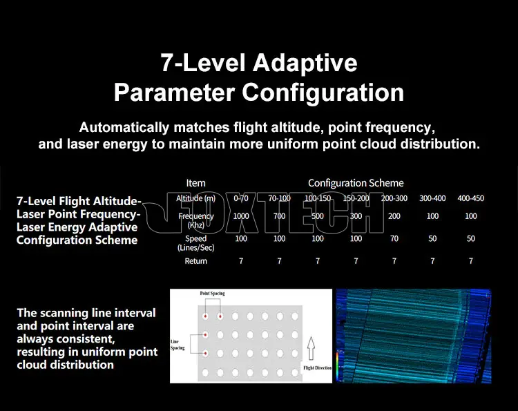
Seven adaptive presets for flight height, pulse repetition rate, and laser energy help maintain uniform scan line spacing and point spacing under different operating conditions.
- Integrated 26MP Mapping Camera
The integrated 26 MP mapping camera supports high-resolution image capture for richer mapping data and colorized point cloud workflows.
- Integrated Software Workflow
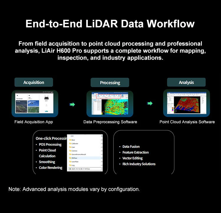
Supports field acquisition, parameter configuration, real-time 3D point cloud preview, data preprocessing, point cloud processing, and professional analysis
YOUR PURCHASE INCLUDES
LiAir H600 Pro LiDAR System ×1
USB Cable ×1
GNSS Antenna ×2
GNSS Antenna Mounting Bracket Set ×2
Power Cable ×2
Tool Kit ×1
Accessory Pack ×1
32GB USB Drive ×1
256GB TF Card ×1
USB 3.2 TF / MicroSD Card Reader ×1
Factory Acceptance Test Report ×1
Product Certification ×1
Delivery Acceptance Form ×1
User Guide ×1
Installation Guide ×1








Related Products


Foxtech
DP500 12.6 MP DJI Drone Oblique Camera Price Used for M300 RTK Or DJI M350 RTK
The DP500 is the first tilt photography module developed based on market demand and compatible with DJI drone platforms,adapting aircraft DJI M300 RTK/DJI M350 RTK., with a total pixel count of 12.6...


Foxtech
Hawk-130X Pro Lidar Scanning System
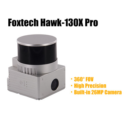
Foxtech Hawk-130X Pro is a compact UAV Lidar point cloud acquisition system, integrated with laser scanner, GNSS satellite positioning system, INS inertial navigation system, and 26MP camera, which...

Foxtech
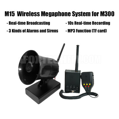
M15 Wireless Megaphone System for DJI M300
M15 is a small-size, lightweight, and long-distance wireless megaphone system designed for DJI M300. The communication range is up to 5km, the sound transmission distance can reach 150m.The onboard...

